Intelligent systems, cloud computing, e-learning, e-health, and e-governance are the driving forces behind the rapid development of the telecommunications industry. This dynamic progress has driven the growth of the fiber optic market.
Our innovative telecommunications solutions rely on these key technologies to create a connected world. We understand the importance of smart connectivity and rely on cutting-edge fiber optic technologies to meet the increasing demands of our digital society.
Fixed Network services
Our services Include
1. FTTH Project Management

Our fiber optic experts in project management play a central role in the timely implementation of our projects. The main task is to ensure smooth communication with municipalities and government agencies, clarify project specifications in the area of fiber optic expansion and manage the schedule.
At the same time, the department monitors and optimizes all internal processes with the primary goal of maximizing cost efficiency while ensuring high-quality network coverage.
This structured approach not only guarantees transparent and effective project management, but also ensures that our fixed network projects are not only completed on time, but also to the highest quality standards.
2. Permits for FTTH projects
Obtaining permits plays a crucial role in any project, especially in the creation of fiber optic networks. Our experienced engineers specialize in the preparation and processing of all necessary permits for the construction of fiber optic networks in the fixed network.
By working closely with the relevant telecommunications providers, we aim to obtain permits in a timely manner to ensure a seamless start to our projects. We pay particular attention to monitoring the validity of the permits during the construction phase. This not only ensures compliance with legal requirements, but also comprehensive network coverage in accordance with the specifications.

3. FTTH Home Inspection
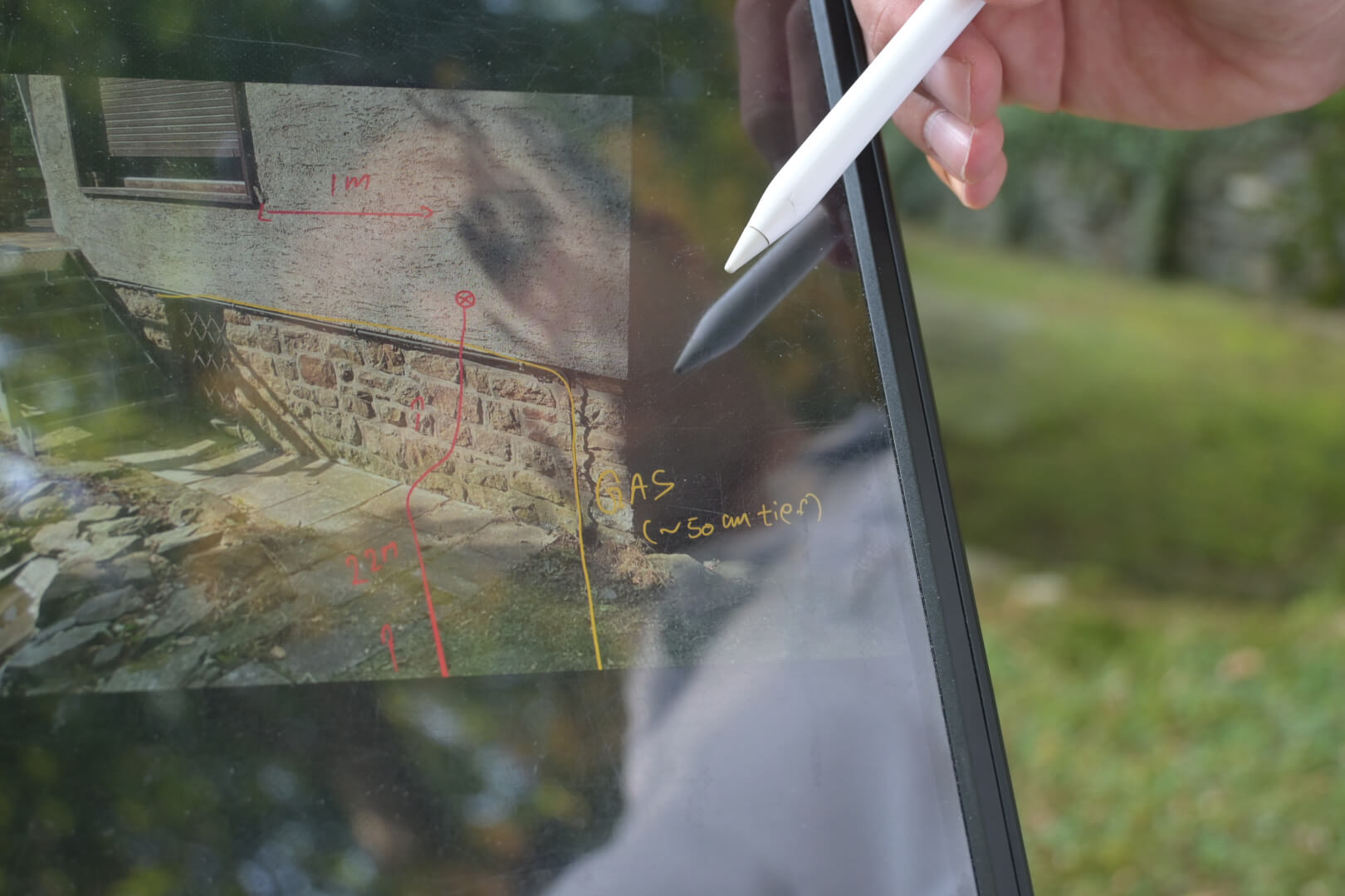
We provide precision home inspections for residential and commercial customers to ensure that your fiber optic construction technical needs are optimally met. Our experienced and certified engineers are passionate about providing the best possible customer experience.
The inspection is carried out on site and is based specifically on the network specifications. Our engineers develop efficient technical solutions in fiber optic construction that are precisely tailored to your needs. The result is recorded in a comprehensive protocol, which is reviewed together with the customer. It contains all the steps, accompanied by relevant photos and detailed information about the fiber optic project.
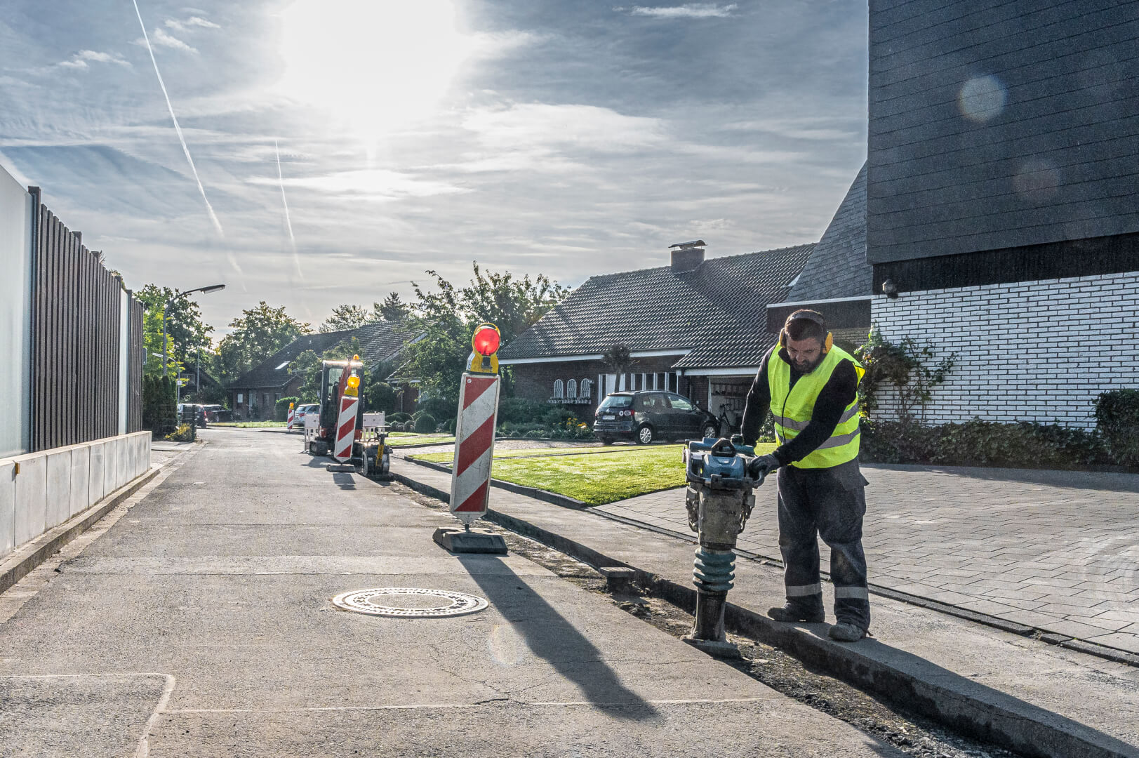
4. FTTH Rollout
Our highly skilled construction crews are equipped with advanced equipment to lay fiber optic cables in various areas (urban, semi-urban, rural) and on all surfaces. Using thorough techniques such as trenching, excavation and horizontal directional drilling, we make the fiber optic rollout efficient and future-oriented for a first-class fixed network, improved network coverage and fast data connections.
Our experienced site managers are specially trained in the areas of technology, health, safety, traffic management and first aid. They are available to provide information and transparency to local authorities or citizens as required.
With a respectful view of the local environment, we ensure that the area is returned to the community in its original state once our work is complete. In this way, we not only focus on efficiency and safety, but also on sustainability in fiber optic expansion.
5. Network Mapping & Design

We meticulously survey sites to determine optimal routes and efficiently plan fiber optic installations. Using advanced equipment, our engineers accurately map routes and identify underground networks.
Collaborating with our experienced network design team and advanced software, we execute high-level and low-level designs for comprehensive network plans covering civil works, telecommunications, and customer connections.
Additionally, we prepare material and service specifications to streamline project preparation and cost analysis. Upon completion, we document the installation process for seamless integration of fiber optic connections, assembly, design, network coverage mapping, and innovative technologies, ensuring a future-proof infrastructure.
6. Fiber Optic House Connection
We provide a comprehensive vertical delivery service for fixed networks, covering the installation and assembly of fiber infrastructure from the point of presence to the end customer. Our expertise extends to the precise installation of fiber optic connections to provide you with reliable and high-performance fixed line services.
Our focus is to ensure high-quality deployment and a robust network infrastructure that meets the specific requirements of our customers.
Once the installation is complete, we provide comprehensive documentation of the infrastructure, including fiber information and measurements. This forms a solid basis for future maintenance requirements.
In addition to customer connections, we set up stand-alone home and business connections in existing network infrastructures. This enables subscribers who could not be connected during the initial network roll-out phase to access high-speed data.
